Update from the YST Project

One of the goals for the Yellowstone Shortline Trail Project is to create a rolling, strolling museum by incorporating wayside exhibits exploring the area’s history, culture, and natural environment. Earlier this year, the YST Committee began searching for a company that could guide the project towards that goal. We talked to companies from all over the U.S. and eventually decided on Sea Reach. The creativity and depth of their portfolio wowed us. For those who are local and want to see Sea Reach's work, go check out the interpretive signage for the auto tour around Quake Lake.
On September 23rd, we kicked off the project with a site visit, inviting members of the Sea Reach team to West Yellowstone. We packed a lot into the two days they were here and want to share the experience with our followers and supporters.
To begin, we had a meeting, which was an opportunity for everyone to get to know one another and for Sea Reach to learn about the goals of the project and the community. We had representatives from the Town of West Yellowstone, Custer Gallatin National Forest, West Yellowstone TBID, Destination Yellowstone, the Yellowstone Historic Center, and Freeheel & Wheel. YST Project Manager Melissa Alder took the lead, providing a meaningful narrative of how the project has developed from a dream that began decades ago. We shared ideas, goals, visions, stories, and more. A special thank you to Three Bear Lodge for providing the perfect meeting place.
After that, the real fun began: visiting the site of the future Yellowstone Shortline Trail. In order to see as much of the trail as we could, we used side-by-sides to travel along a motorized route that parallels the abandoned railroad bed. We owe a huge thank you to Yellowstone Adventures and Highmark Rentals for hooking us up with side-by-sides for the day.


The weather could not have been more perfect for the adventure! We started at the Union Pacific Pylon, which is located at the east end of the West Yellowstone Oregon Shortline Terminus Historic District. The original terminus of the railroad would have been in the area now occupied by the Chamber of Commerce. Crossing Canyon Street, we took a look at the Centennial Train Car and Union Pacific Depot.


Next, we continued west towards Iris Street. Then we covered the stretch of the trail that goes through the Town's planned 80-acre expansion, imagining what the area might look like in the future. The 80 acres shares a border with Custer Gallatin National Forest. As soon as people leave the in-town portion of the trail, they will enter beautiful national forest lands.

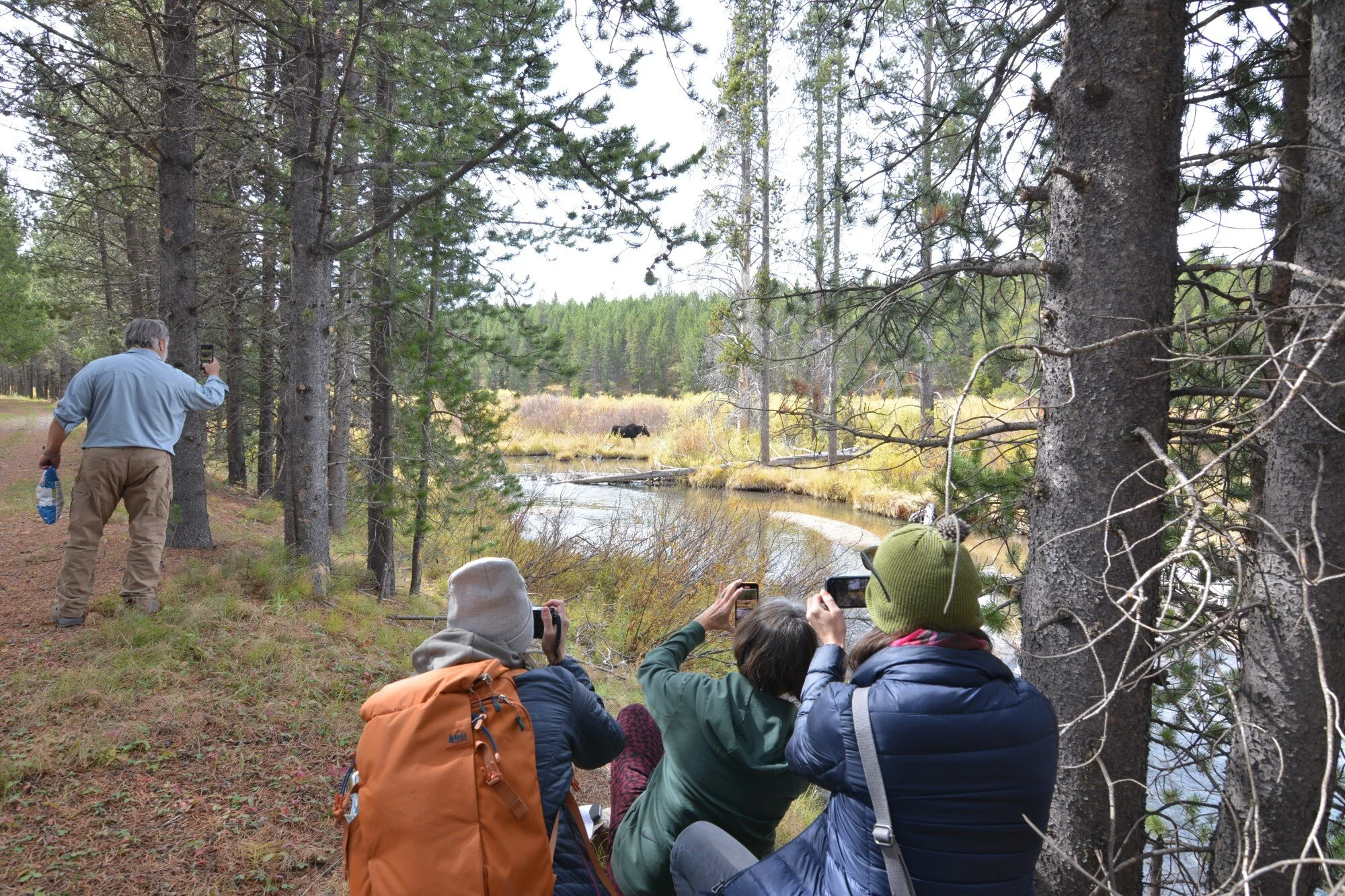
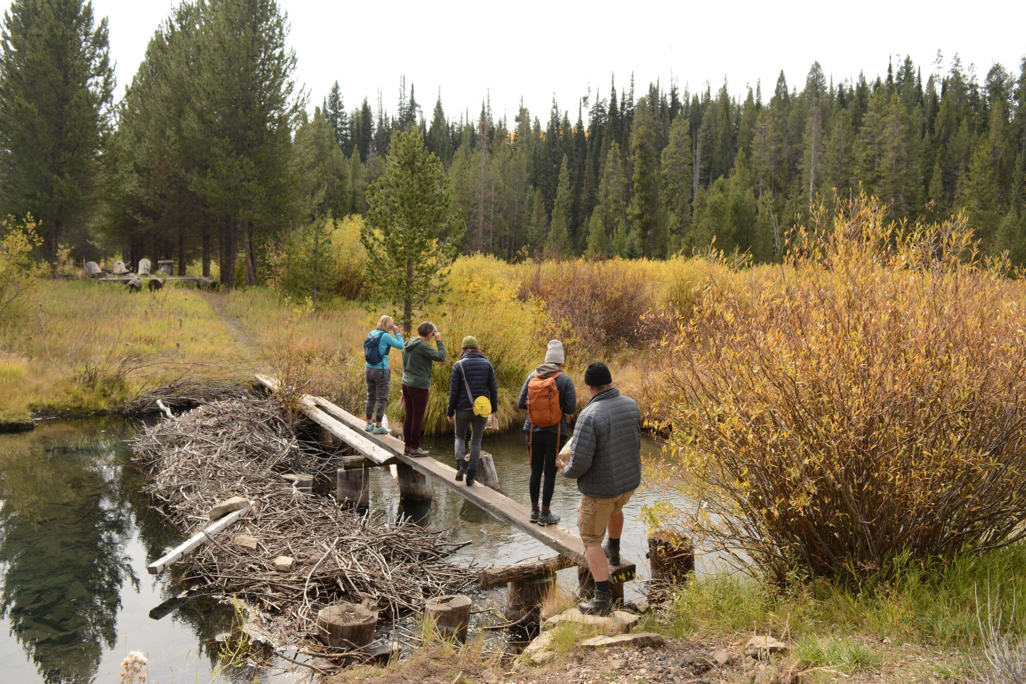
We then hopped onto Old Airport Road and took it to Railroad Spur Road. From there, we hiked to the first river crossing. On the way, we passed the old railroad summer homes and saw a moose near the river, meandering through the brush. Across the makeshift bridge, we found a part of the old train bridge which ended up providing the perfect spot for a picnic. (Friendly reminder: pack it in, pack it out!) Over lunch, we discussed all the different possibilities for stories and topics that could be told and explored along the trail.

After lunch, we continued to South Fork Road and could view the trail across the South Fork of the Madison River to the east. We then arrived at a spot where we could hike to the future site of the second bridge. The water there was so calm and clear and we could once again see remnants of an old train bridge. All along the way, Randy, with Custer Gallatin National Forest, taught us all about geology, wildlife, trees, and plants found in the area.

Second bridge location. Remnants of the old railroad bridge can be seen above the water’s surface.
We continued following South Fork Road and eventually came up on a place near Mosquito Gulch where we could pull off the road to the east, right next to the river. At this location, the trail rises high above the river. We were able to cross the shallow river and scramble up above to the trail. The view from up there was unlike anything we had seen along the trail so far.

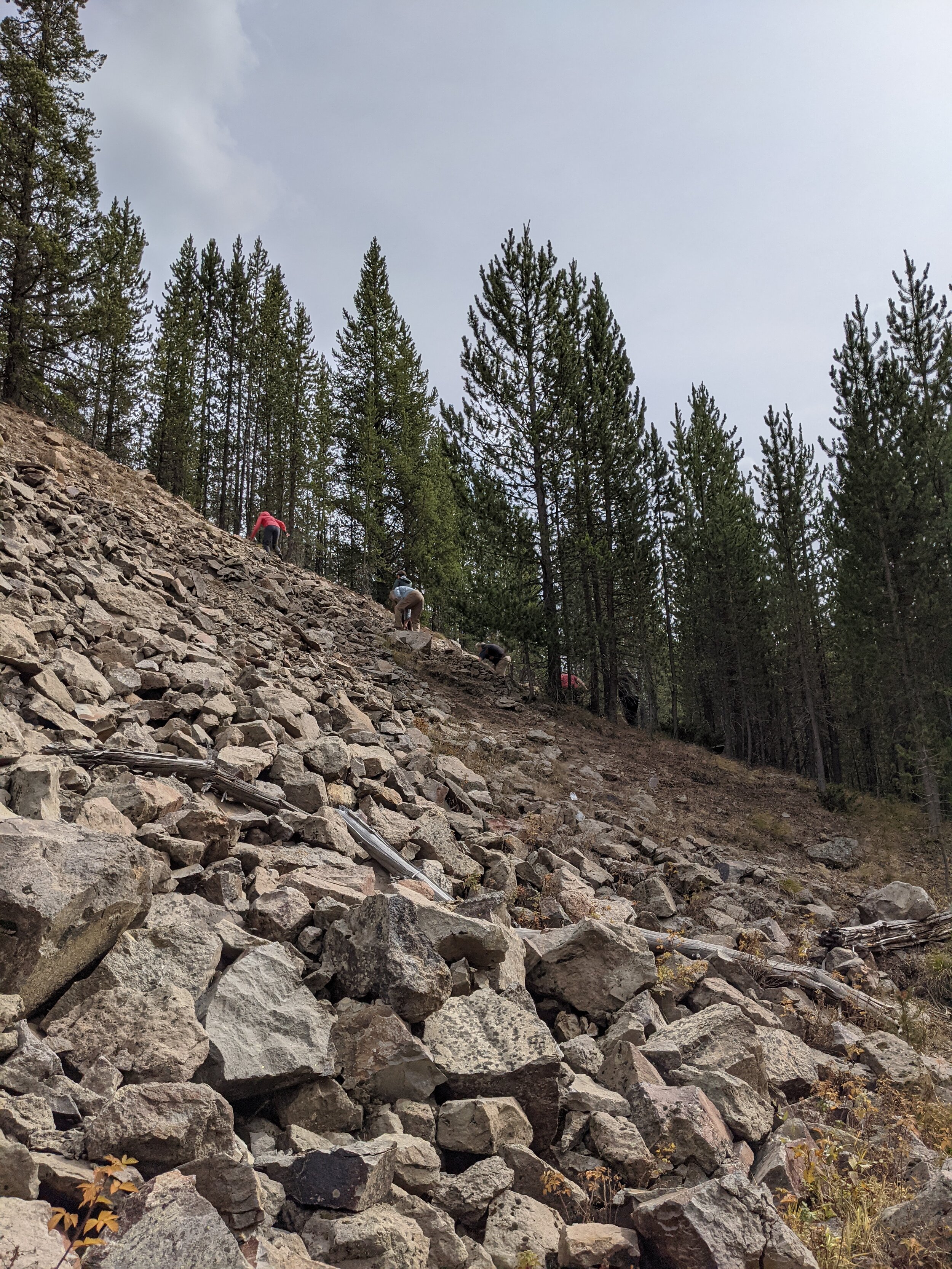

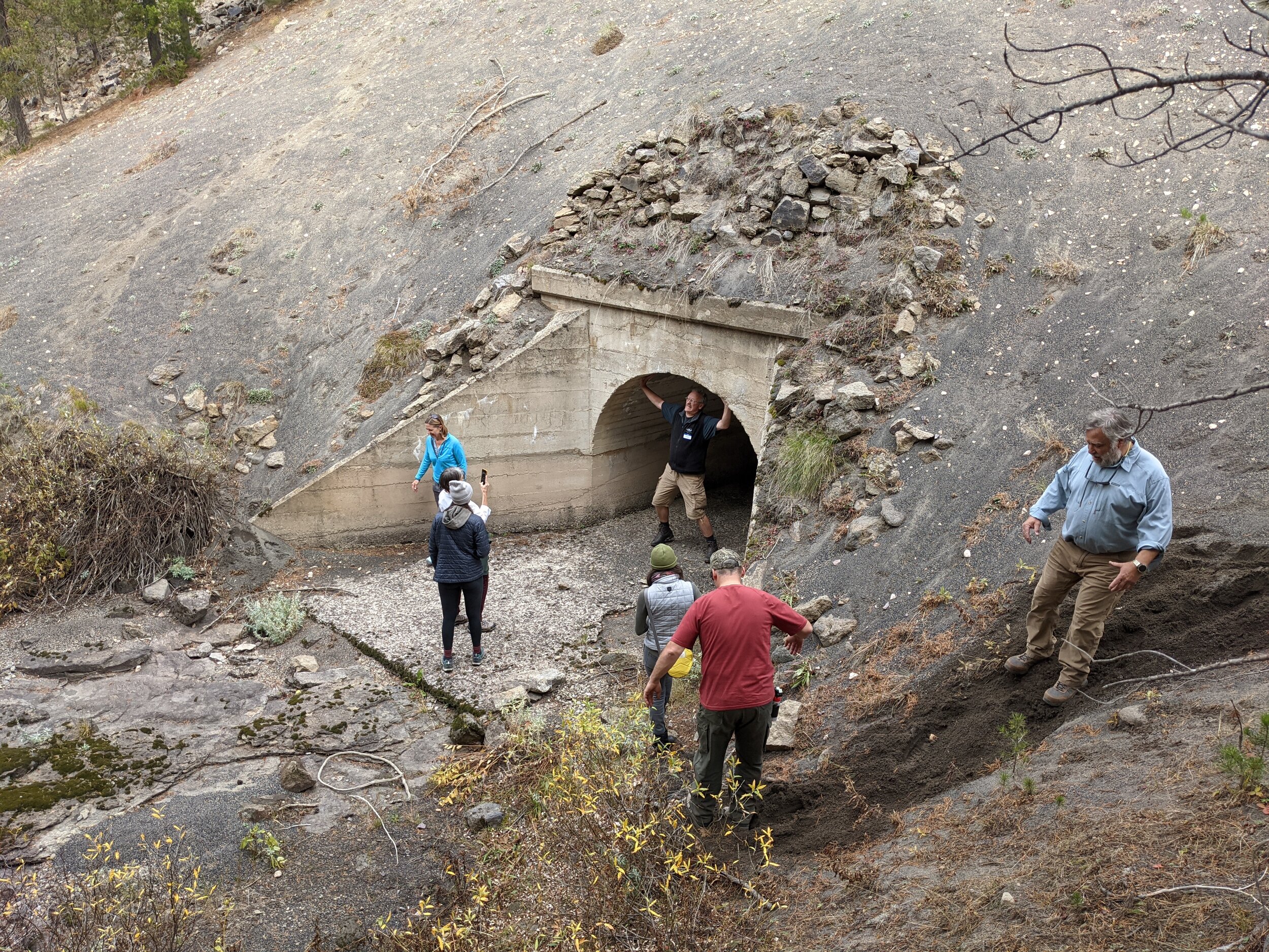
As we started hiking, we went past burn piles where forest service personnel have already started clearing brush to enable equipment to get through. Then we came across an area that had been infilled and we could see the top of a culvert below. We continued on, having a hard time resisting seeing what was around the next bend… and the next. As we made our way back, we took a different route, allowing us an up-close look at the culvert.


After this, South Fork Road deviates from the trail for a while. Finally, we arrived at the Reas Pass junction and hiked a little more, heading towards the Montana-Idaho state line. By then, it was time to head back to West Yellowstone for the evening.
Near the Montana-Idaho state line.
The following morning, we met at the Depot to begin a walking tour of the historic district. In addition to wanting to learn about the history of the buildings and the community, Sea Reach was also interested in seeing the architecture and aesthetics of the historic buildings to use as inspiration. Their goal is to design aesthetically-pleasing wayside exhibits that fit in with the surrounding environment. Giving them an inside look of the Depot and Dining Lodge buildings really helped convey the significance and charm of West Yellowstone's historic district.
After two busy days filled with enthusiasm, exploring, and brainstorming, the Sea Reach team headed out. Over the winter, we will be working closely with them as plans develop.
This project would not be possible without YST supporters and the local community. Thank you to all who have helped make this possible! We are one step closer to our vision of having a “rolling, strolling museum” through immersive learning!


